MOLA High Resolution Digital Elevation Model of the
The MOLA investigation is providing input to the Mars '98 mission and science teams for the purpose of characterizing their landing site region. Using data through June 10, 1999 we have derived a high-resolution model of the regional topography and surface roughness within their landing corridor.
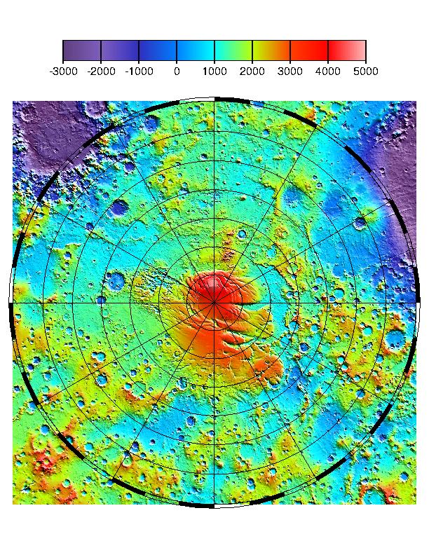
The context image shows the latest MOLA topographic map of Mars' from latitude 55° S to the south pole. Values of elevation on the color scale are in meters. The along-track resolution of MOLA profiles is 330 m. Vertical precision of individual elevations aproaches 37 cm. Absolute accuracy of the grid with respect to Mars' center of mass is <10 m. Note that there is a gap in data within 2.8° of the south pole due to the inclination of the MGS orbit. This gap will be filled in later this month by tilting the MGS spacecraft to an off-nadir ranging configuration. The MPL landing site region is between latitudes 72° and 78° S and longitudes 130° to 190° E. (Credit: MOLA Science Team)
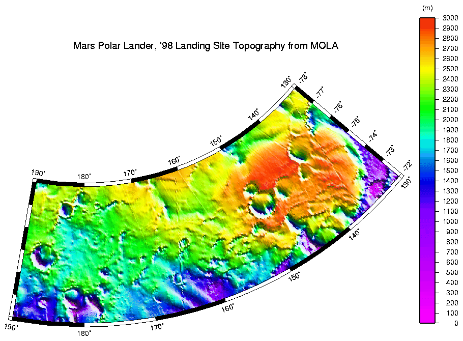
High resolution digital elevation model of the MPL landing site corridor based on observations through MGS Orbit Trim Maneuver-2 on June 10, 1999. (Credit: MOLA Science Team)
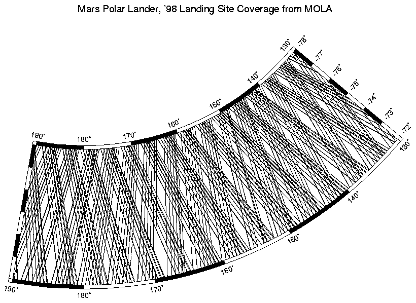
MOLA profile coverage in the MPL landing site corridor. This plot shows the distribution of data that was used to make the above high-resolution digital elevation model.
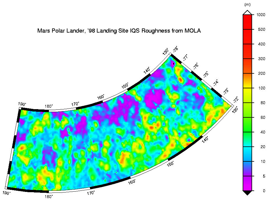
Interquartile-scale roughness of the MPL landing site corridor. This chart shows the roughness of the surface within the landing site region at a spatial scale of about 1 kilometer. (Credit: MOLA Science Team)
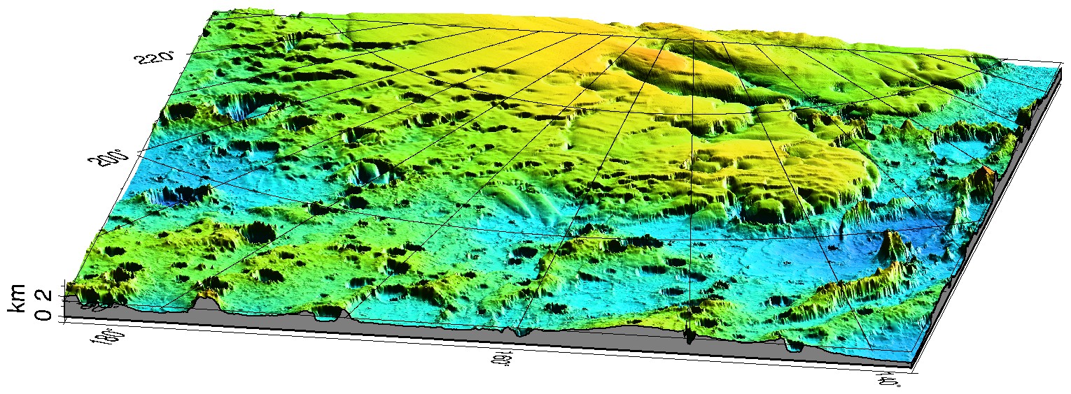
Three-dimensional, false-color view of the Mars '98 Polar landing site from MOLA. The vertical exaggeration is 20: 1. (Credit: MOLA Science Team)
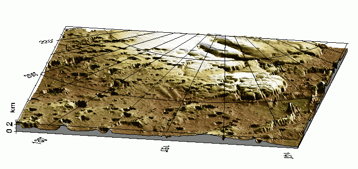
Three-dimensional view of the Mars '98 Polar landing site from MOLA. Here the topographic model has been superimposed on a Viking Orbiter color mosaic to provide a natural color view. The vertical exaggeration is 20: 1. (Credit: MOLA Science Team)
Graphics by Greg Neumann and Oded Aharonson.
Back to MOLA home
page