Mapping and Extended Mission Results
NEW!
CO
2
snow and water ice content in Mars' northern hemisphere
Recent Polar Radiometry Measurements
Radiometry of Syrtis Major
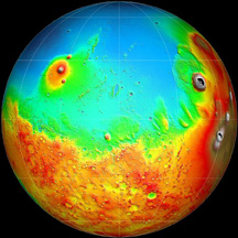
More MOLA roughness maps
Seasonal Variations of Snow Depth on Mars
appearing in the December 7, 2001 issue of
Science
.
High-resolution shaded relief quadrangle maps
Initial Results from MOLA Passive Radiometry
MOLA observations of the recent Martian dust storm
Shaded Relief image of the Argyre basin
, as featured in the Mars Insight issue of
Nature
Improving spatial resolution of topography
Regional closeups of Martian topography
The enigmatic northern plains of Mars
, as published in the April 5, 2001 issue of
Nature
Ancient Geodynamics and Global-scale Hydrology on Mars
, as published in the March 30, 2001 issue of
Science
Dry ice clouds and snow
National Geographic
map of Mars using MGS MOLA and MOC data
A high-resolution global shade map
Tharsis/Chryse image,
as published in the February 2001 issue of
Sky and Telescope
PRODUCED BY POPULAR DEMAND!
MOLA map with major surface features labeled
Publication-quality global and polar shaded relief images
Global Slope and Roughness Maps
Major Martian Volcanoes
MOLA Views of Valles Marineris
Regional maps of Mars from the first year's worth of MOLA global mapping data
Internal Structure of Mars and Evidence for Buried Channels
, as published in the March 10, 2000 issue of
Science
Excellent(!) Visualizations of Mars' internal structure and topography
from the NASA/Goddard
Scientific Visualization Studio
Topographic power spectrum of Mars from MOLA
High-Resolution Map of the Mars '98 Polar landing site (January, 2000)
Evidence for possible ancient oceans on Mars from MOLA
The latest high-resolution global maps from MOLA
-- May 28, 1999
Science
cover reprise
MOLA Views of the Mars '98 Polar landing site (December, 1999)
Table of Mars geodetic parameters from MOLA
Regional map of the Tharsis and Chryse regions,
as featured in the October, 1999 issue of
Physics Today
Quarter-degree global topographic map of Mars
The first high-accuracy digital elevation model of the Mars Polar Landing site from MOLA (July 1999)
The first high accuracy global map of Mars from MOLA
NASA Press Release of MOLA Global Map and more global topographic images
Profiles across the north and south polar caps
First profiles of the southern hemisphere
, presented at the 30th Lunar and Planetary Science Conference
Back to MOLA home page
Direct inquiries to:
zuber@tharsis.gsfc.nasa.gov