Improving Spatial Resolution of Surface Topography
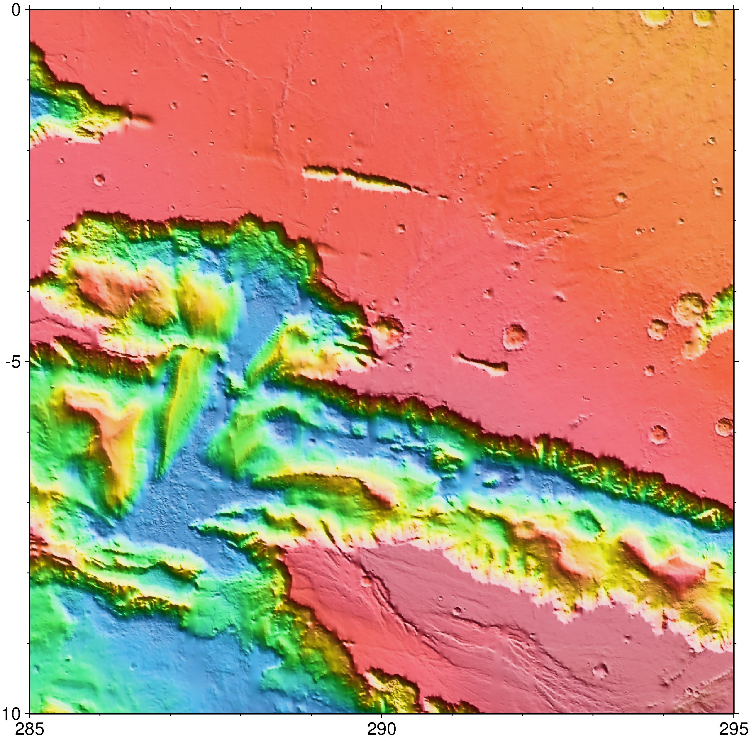
Over the course of the Mars Global Surveyor mapping and extended missions, the spatial resolution of MOLA topography on the surface of Mars has continued to improve significantly. Below we illustrate the improvement in the vicinity of the Melas Chasm region of the Valles Marineris canyon system. Using MOLA data collected in all MGS mission phases, topographic images with resolution as fine as 1/256 degree are possible. (On Mars one degree is approximately 59 km at the equator.) (Image Credit: MOLA Science Team)
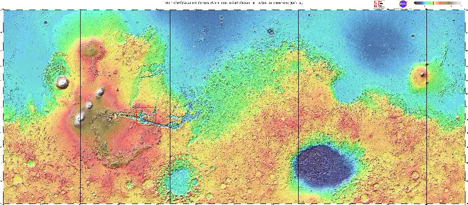
Global topography of Mars from MOLA. The red box shows the region highlighted in the figures below. (Image Credit: MOLA Science Team)
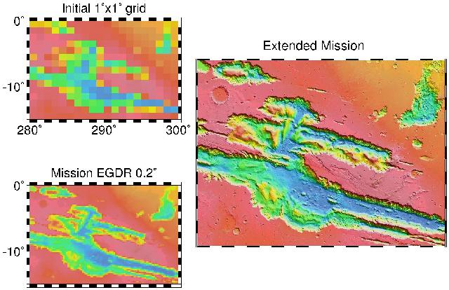
Upper left: 1° x 1° (59 x 59 km2) grid, the resolution of MOLA's first global topographic model.
Lower left: 0.2° x 0.2° (11.8 x 11.8 km2) grid, the resolution the we had originally hoped we would achieve at the end of the MGS global mapping mission.
Right: 0.0039° x 0.0039° (0.23 x 0.23 km2) grid, the resolution we are obtaining at low latitudes in the MGS extended mission.
(Image Credit: MOLA Science Team)
Return to the MOLA Science homepage
Direct inquiries to: dsmith@tharsis.gsfc.nasa.gov