Higher-resolution version
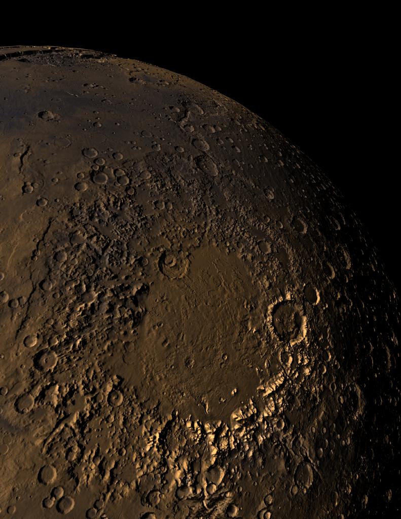
MOLA topographic image of Mars' Argyre impact basin that shows the degraded nature of the ancient basin topography. This shaded relief image clearly shows a continuous flow route that runs from the north rim of Argyre to the Chryse outflow region. The eastern part of the Valles Marineris can be seen at the top of the figure near the planetary limb. The image was produced by combining MOLA altimetry with color from a Viking image mosaic. Illumination is from the west. (Image Credit: MOLA Science Team and G. Shirah, NASA GSFC Scientific Visualization Studio.)