 |
National Aeronautics and Space Administration Goddard Space Flight Center |
SEARCH NASA |

 MOLA MOLA |
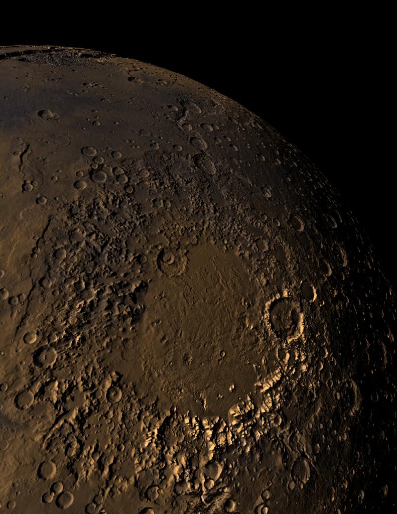
MOLA topographic image of Mars' Argyre impact basin that shows the degraded nature of the ancient basin topography. This shaded relief image clearly shows a continuous flow route that runs from the north rim of Argyre to the Chryse outflow region. The eastern part of the Valles Marineris can be seen at the top of the figure near the planetary limb. The image was produced by combining MOLA altimetry with color from a Viking image mosaic. Illumination is from the west. (Image Credit: MOLA Science Team and G. Shirah, NASA GSFC Scientific Visualization Studio.)
This image was featured on the cover of the Mars Insight feature in the July 12, 2001 issue of Nature.
Several of the papers in the insight issue were authored by members of the MOLA Science Team. They are:
Carr, M.H., and J.B. Garvin, Mars exploration Nature, 412, 250-253, 2001.
Jakosky, B.M., and R.J. Phillips, Mars' volatile and climate history, Nature, 412, 237-244, 2001.
Zuber, M.T., The crust and mantle of Mars, Nature, 412, 220-227, 2001.