 |
National Aeronautics and Space Administration Goddard Space Flight Center |
SEARCH NASA |

 MOLA MOLA |
Presented at the Mars '98 Landing Site Science Press Conference
Jet Propulsion Laboratory, December 2, 1999
and Updated High-Resolution Landing Site Maps Showing Most Likely
Landing Locations of MPL AND DS-2 Based on Post-Landing Navigation Reconstructions
Pre-Landing Maps
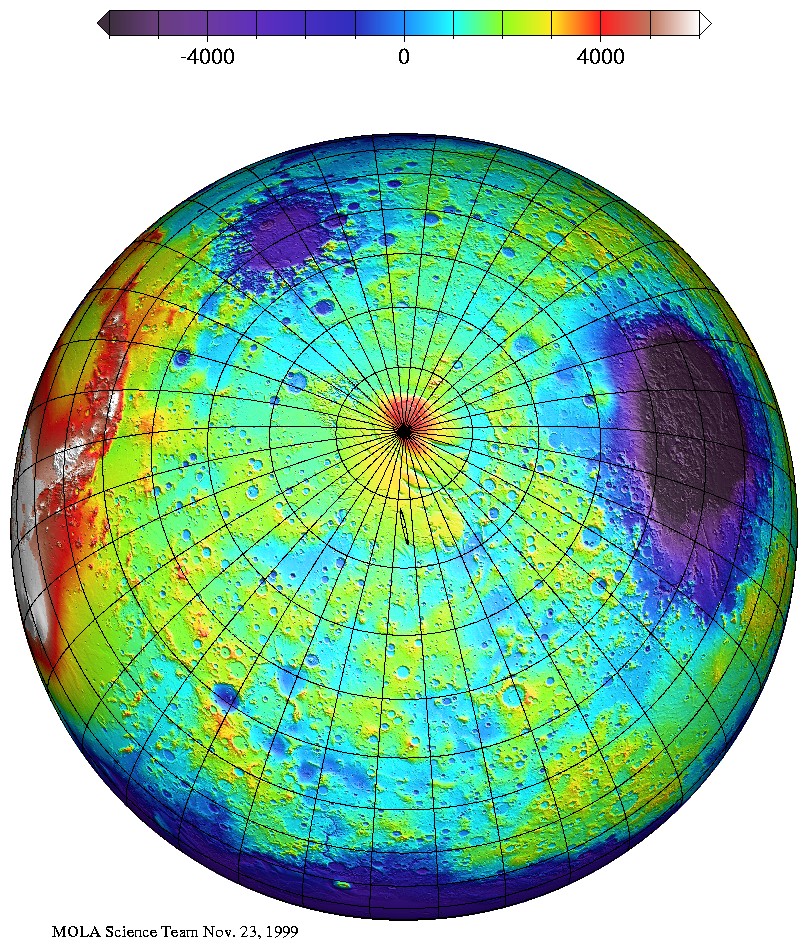
View of the Mars '98 landing region as viewed from 40,000 kilometers from Mars. The figure is a high-resolution, false-colored orthographic projection of Mars topography from the Mars Orbiter Laser Altimeter (MOLA). The topographic model is based on a global grid compiled from about 200,000,000 MOLA elevation measurements. The accuracy of the topographic model is <5 m and the spatial resolution is about 15 kilometers globally but approximately 3 kilometers at the landing site. The Mars Polar Lander is believed to have landed in the south polar layered terrains within the landing ellipse shown in black. The Hellas impact basin is the large circular structure on the right of the image and the Argyre impact basin lies at the top left. (Credit: MOLA Science Team)
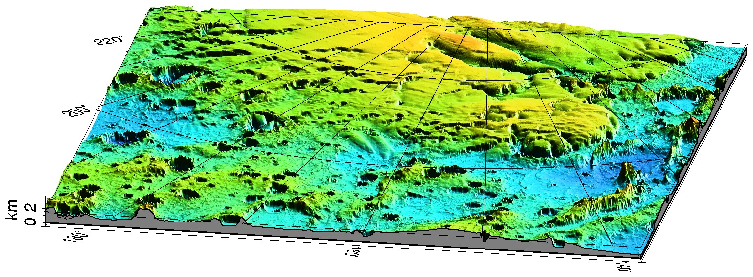
False-color, three-dimensional view of the Mars '98 landing region and surroundings. The landing site lies within the south polar layered terrains which are elevated by about 2.5 kilometers above the surrounding cratered highlands of Mars' southern hemisphere. The layered terrains are believed to consist of layers of ice and dust deposited on seasonal and long-term climatic cycles on Mars. The latest estimate of the expected lander position is latitude -76.6° S, 165° E. Efforts are underway to understand the nature of the terrain in which the lander presumably set down. (Credit: MOLA Science Team)
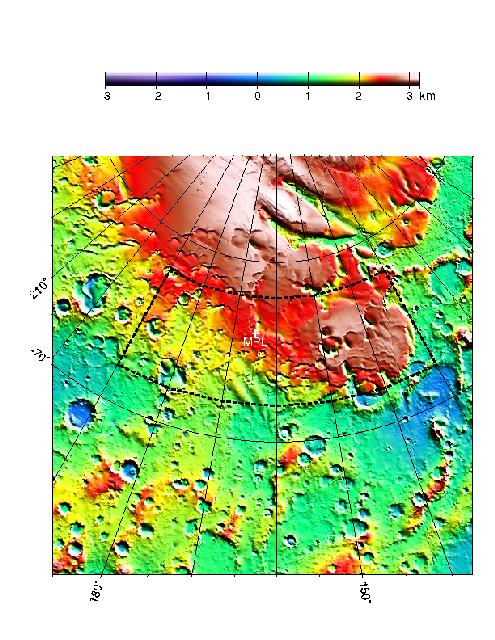
False-color high resolution topographic map of the Mars Polar Lander landing zone in Mars' south polar region. The white plus sign indicates the target landing site. The black dashed box is the broad landing zone from which the specifica site was chosen by NASA based on navigation and landing safety considerations. (Credit: MOLA Science Team)
False-color high-resolution topographic map of the Mars Polar Lander landing zone in Mars' south polar region. The white plus sign indicates the target landing site. The black dashed box is the broad landing zone from which the specifica site was chosen by NASA based on navigation and landing safety considerations. (Credit: MOLA Science Team)
Post-Landing Maps of Lander and DS-2 Locations Based on Navigation Reconstructions
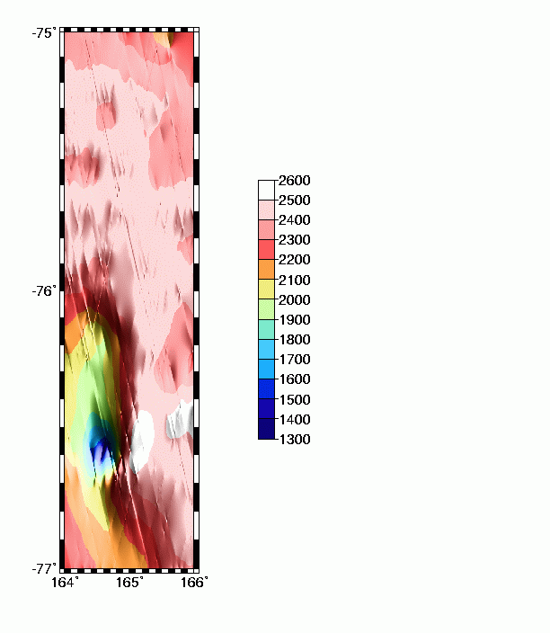
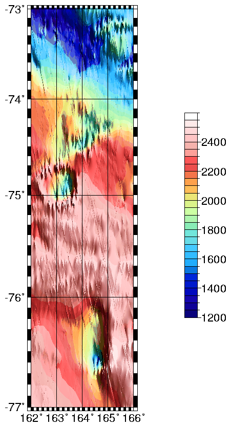
False-color topographic map of the Mars Polar Lander landing zone. This map contains all MOLA data through December 3, 1999. The probable landing location is -76.6° S, 165° E (Credit: MOLA Science Team)
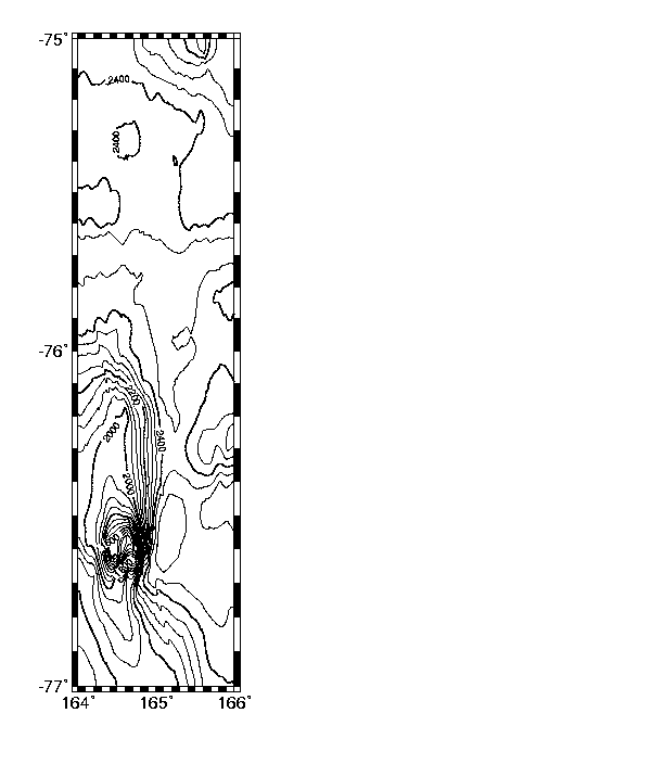
Topographic contour map of the Mars Polar Lander landing zone. This map contains all MOLA data through December 3, 1999. The probable landing location is -76.6° S, 165° E (Credit: MOLA Science Team)
Topographic contour map of the Mars Polar Lander landing zone. This map contains all MOLA data through December 3, 1999. The probable landing location is -76.6° S, 165° E (Credit: MOLA Science Team)
Return to the MOLA Science homepage