 |
National Aeronautics and Space Administration Goddard Space Flight Center |
SEARCH NASA |
 MOLA MOLA |
With one year of global mapping of the Mars Global Surveyor mission completed, the MOLA dataset has achieved excellent spatial and vertical resolution. The maps below have been produced from the altimetric observations collected during MOLA's first year of global mapping and provide a variety of regional topographic views of the Martian surface. The maps were compiled from a data base of 266.7 million laser altimetric measurements collected between March 1, 1999 and February 29, 2000. In each map the spatial resolution is approximately 1/16° by 1/32° (where 1° on Mars is about 59 km) and the vertical accuracy is approximately 1 meter. Note that the sizes of the regions vary.
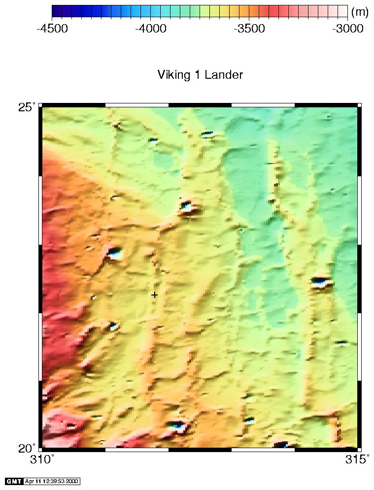
Viking 1 landing site: 20° to 25° N; 310 to 315° E. The landing site is marked by the plus sign. (Credit: MOLA Science Team)
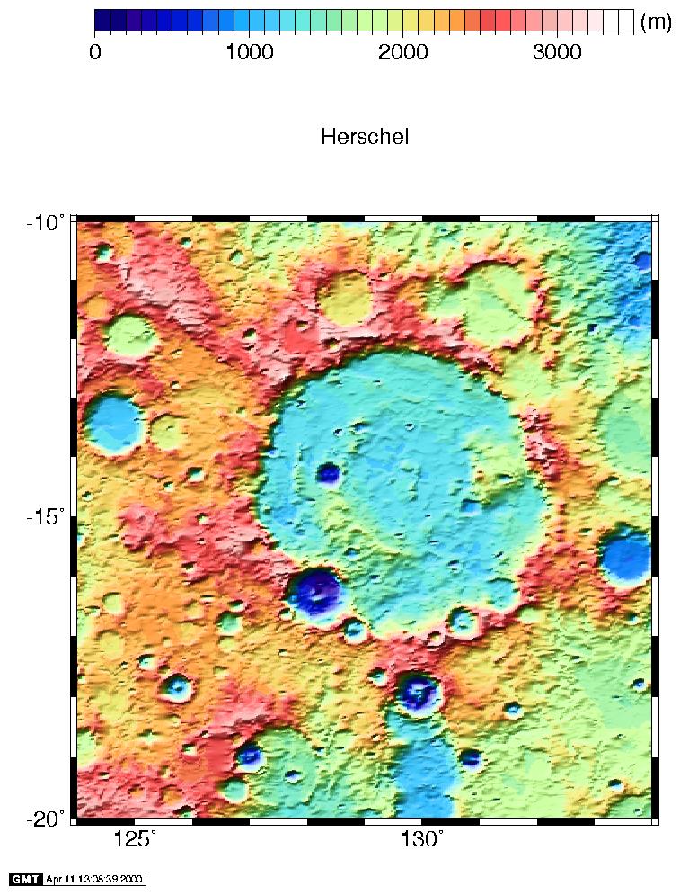
Herschel crater: 10° to 20° S; 124 to 134° E (Credit: MOLA Science Team)
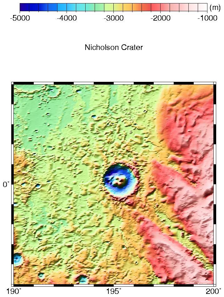
Nicholson crater: 5° S to 5° N; 190 to 200° E (Credit: MOLA Science Team)
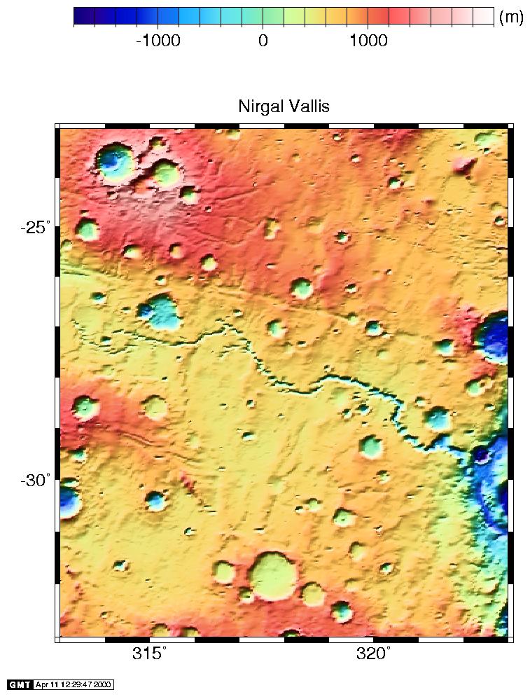
Nirgal Vallis region: 23° to 33° S; 313 to 323° E (Credit: MOLA Science Team)

Syrtis Major: 5° to 15° S; 62 to 72° E (Credit: MOLA Science Team)
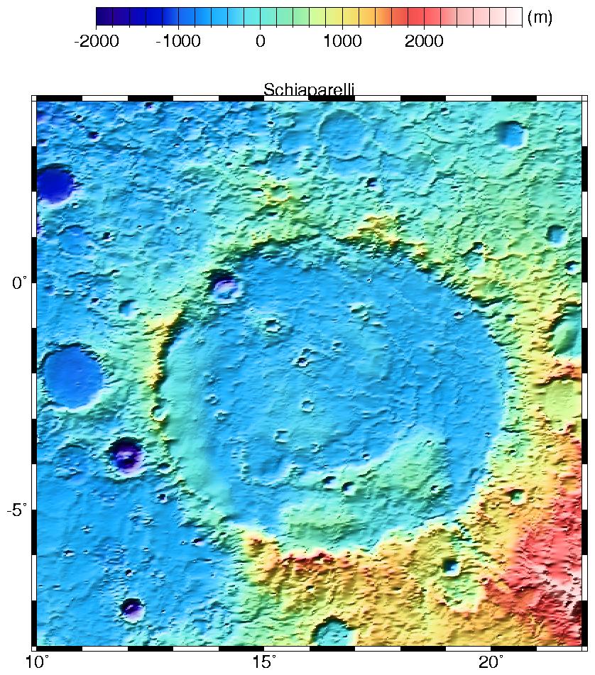
Schiaparelli crater: 8° S to 2° N; 12 to 22° E (Credit: MOLA Science Team)
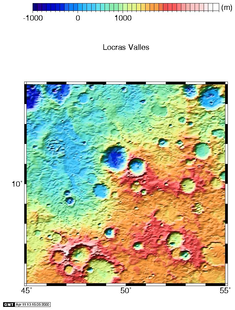
Locras Valles region: 5° to 15° N; 45 to 55° E (Credit: MOLA Science Team)
Back to MOLA home page