NASA logo - links to main NASA web site National Aeronautics and Space Administration
Goddard Space Flight Center
  SEARCH NASA
 
Improving Spatial Resolution of Surface Topography

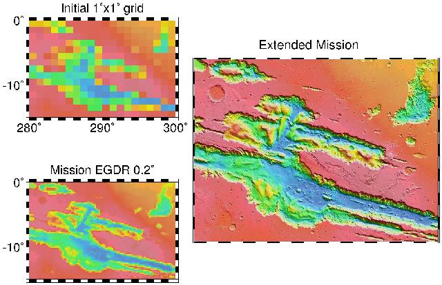
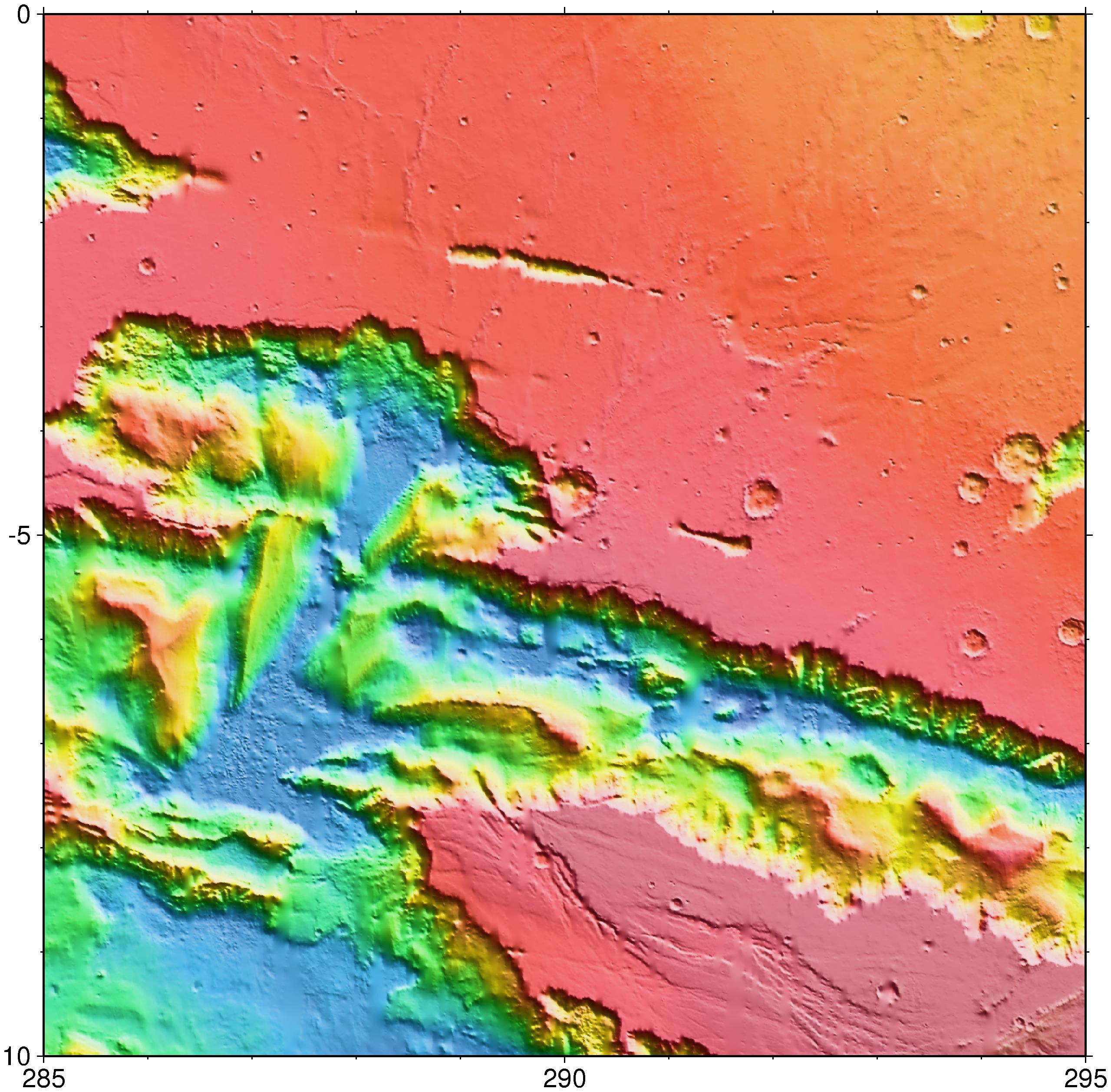
Over the course of the Mars Global Surveyor mapping and extended missions, the spatial resolution of MOLA topography on the surface of Mars has continued to improve significantly. Below we illustrate the improvement in the vicinity of the Melas Chasm region of the Valles Marineris canyon system. Using MOLA data collected in all MGS mission phases, topographic images with resolution as fine as 1/256 degree are possible (on Mars one degree is approximately 59 km at the equator) (Image Credit: MOLA Science Team)

Location map

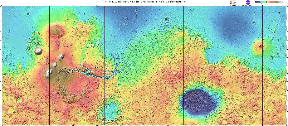
Global topography of Mars from MOLA. The red box shows the region highlighted in the figures below. (Image Credit: MOLA Science Team) (View larger image)

3 resolutions

Upper left: 1° x 1° (59 x 59 km2) grid, the resolution of MOLA's first global topographic model.

Lower left: 0.2° x 0.2° (11.8 x 11.8 km2) grid, the resolution the we had originally hoped we would achieve at the end of the MGS global mapping mission.

Right: 0.0039° x 0.0039° (0.23 x 0.23 km2) grid, the resolution we are obtaining at low latitudes in the MGS extended mission.

(Image Credit: MOLA Science Team)

 
NASA logo - links to main NASA web site + USA.gov
+ Inspector General Hotline
+ Budgets, Strategic Plans and Accountability Reports
+ Freedom of Information Act
+ The President's Management Agenda
+ Privacy Policy and Important Notices
  Responsible NASA Official: Michael Barker
Contact: Dandan Mao
Webmaster: Lori J. Tyahla