 |
National Aeronautics and Space Administration Goddard Space Flight Center |
SEARCH NASA |
 MOLA MOLA |
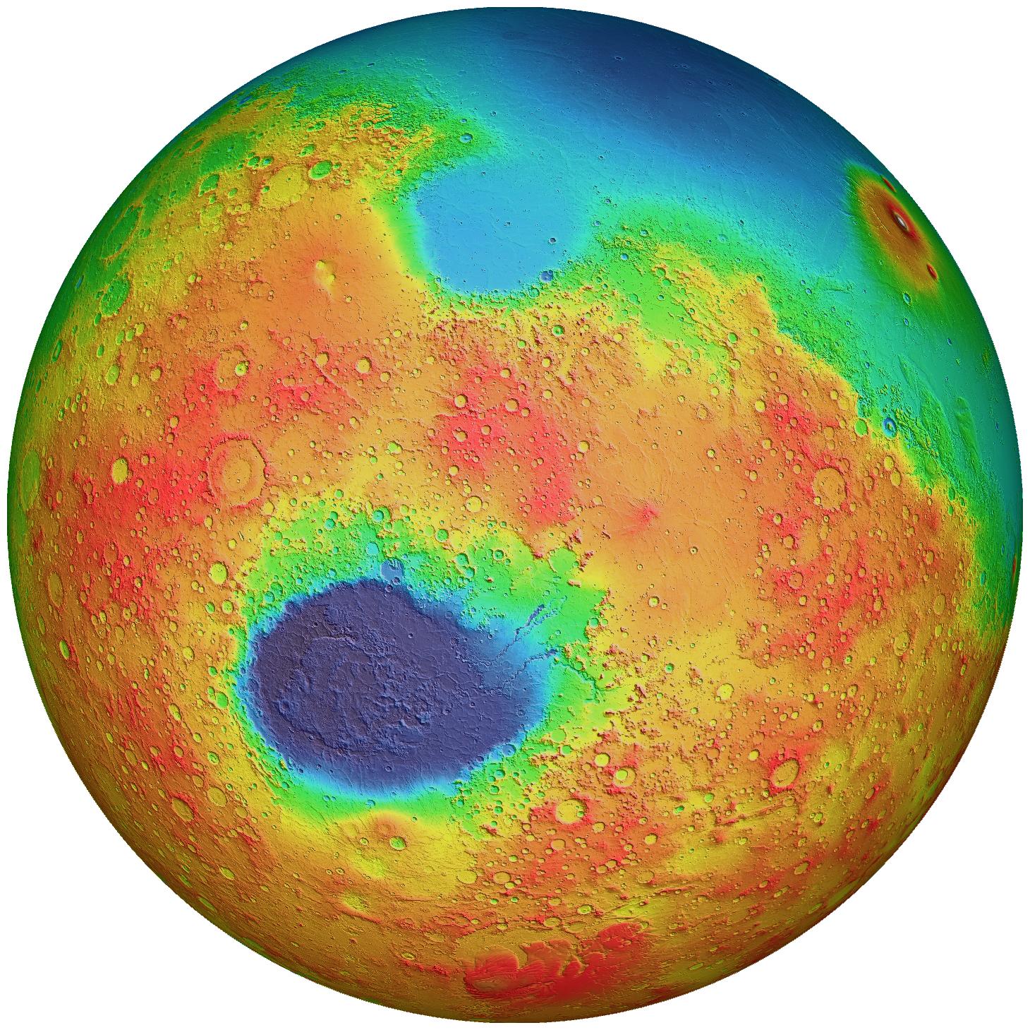
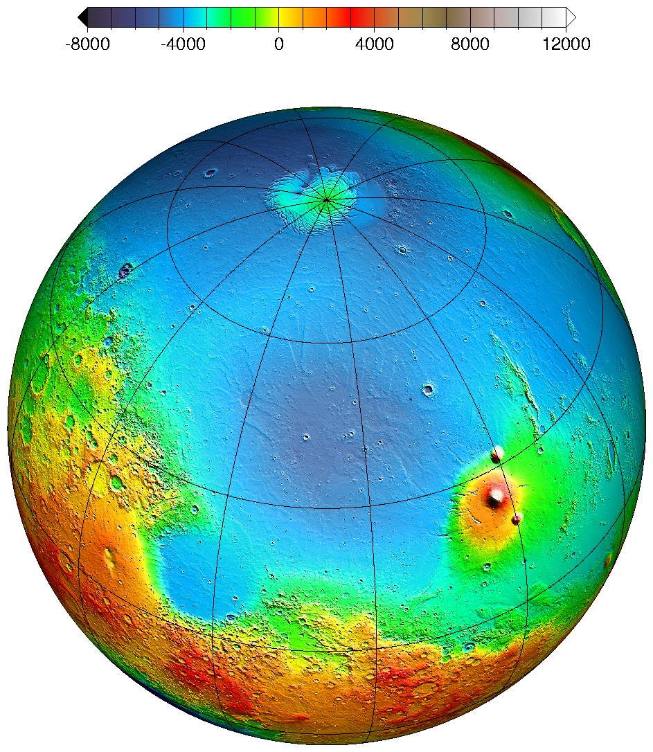
The maps below are global false-color topographic views of Mars at different orientations from the Mars Orbiter Laser Altimeter (MOLA). The maps are orthographic projections that contain over 200,000,000 points and about 5,000,000 altimetric crossovers. The spatial resolution is about 15 kilometers at the equator and less at higher latitudes. The vertical accuracy is less than 5 meters. The first two maps are a "re-do" of the MOLA cover of Science on May 28, 1999. (Check out the improvement!) The first features the Hellas impact basin (in purple, with red annulus of high standing material). The second features the Tharsis topographic rise (in red and white). The third figure illustrates the fascinating subtle textures associated with resurfacing of the northern hemisphere lowlands in the vicinity of the Utopia impact basin (at the near-center of the image in blue). (All images credited to: MOLA Science Team)

Return to the MOLA Science homepage
Return to the MOLA Science homepage